Nautical Charts — OsmAnd 1.0
Free Version
Publisher Description

Nautical Charts — OsmAnd - OsmAnd Nautical Charts is a plugin that provides Nautical Maps
Nautical Charts — OsmAnd is an extension for OsmAnd Maps & Navigation app that provides free nautical charts for offline use. This sea map will be your reliable companion whether you are going fishing or planning a sea travel.
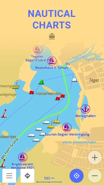
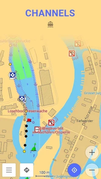
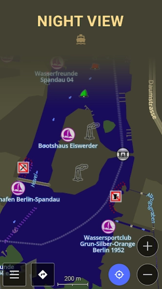
Nautical Charts are a detailed graphical representation of oceans, seas, coastal areas, and rivers. The charts can contain various information like sailing routes, navigation lights, dangerous areas, areas where it's allowed or not allowed to sail or dock, etc.
These maps are also supplemented with the information about the depth contours and nautical depth points that add valuable layers of data to the map.
All the professional sailors are obliged to have official marine charts
on their ships. These charts are published by authorized agencies and cost quite some money. Agencies are investing a lot in keeping the charts up to date. They release updates for the charts on a regular basis, but because of the fact that reviewing the information and processing the updates takes quite some time, the nautical charts are never completely up-to-date.
Nautical charts by OsmAnd are based on the data from the OpenSeaMap project. The idea of the project is to build the detailed map by people who actually use it. Every user of the map can contribute by adding changes to it making it more detailed and more accurate.
While OpenSeaMap charts at the moment cannot compete with official nautical charts, they can be used by recreational sailors for orientation or route planning. This plugin does not provide nautical navigation but it is your offline reference tool that can be used together with other navigational programs.
Usage Instructions: it is highly recommended to download nautical basemap in order to see the maps regardless of detailed map presence. Nautical charts are provided as a map and a special style, to switch style in OsmAnd please use the menu item 'Configure Map' on the map screen.
About Nautical Charts — OsmAnd
Nautical Charts — OsmAnd is a free app for Android published in the Recreation list of apps, part of Home & Hobby.
The company that develops Nautical Charts — OsmAnd is OsmAnd. The latest version released by its developer is 1.0.
To install Nautical Charts — OsmAnd on your Android device, just click the green Continue To App button above to start the installation process. The app is listed on our website since 2023-02-13 and was downloaded 11 times. We have already checked if the download link is safe, however for your own protection we recommend that you scan the downloaded app with your antivirus. Your antivirus may detect the Nautical Charts — OsmAnd as malware as malware if the download link to net.osmand.nauticalPlugin is broken.
How to install Nautical Charts — OsmAnd on your Android device:
- Click on the Continue To App button on our website. This will redirect you to Google Play.
- Once the Nautical Charts — OsmAnd is shown in the Google Play listing of your Android device, you can start its download and installation. Tap on the Install button located below the search bar and to the right of the app icon.
- A pop-up window with the permissions required by Nautical Charts — OsmAnd will be shown. Click on Accept to continue the process.
- Nautical Charts — OsmAnd will be downloaded onto your device, displaying a progress. Once the download completes, the installation will start and you'll get a notification after the installation is finished.
